Helen is an independent graphic designer with a background in (mostly) digital design. She also makes paper maps and posters of her macro-scale tube style walking maps of UK cities. She loves making these maps as they give her the opportunity to explore and discover new urban green spaces.
Tell us a little about yourself
I lived in Bristol from 2006-2008 studying MA Animation at UWE and lived in London from 2010-2012. I then travelled for a year (visiting many urban green spaces) and returned to Tallinn, Estonia afterwards. After trying few things here and there and not really finding my place, I started to make green infographics and maps about two years ago. Now I’ve just moved to a (very small!) studio at the Creative Incubator in Tallinn to concentrate on the Greenground Maps.
How important do you think green spaces are?
Green spaces are vital for our well-being, especially for us living in the cities. Historically people have evolved together with nature and I think we prefer seeing landscapes over built up urban environments. This is why we feel calmer when surrounded by nature, our eyes are more adjusted to scanning the trees in the forest than cars on the busy streets. The sound of nature is just as important, but in cities you really have to work hard to find quiet spaces. Being in alert all the time is really exhausting for our brain. We need green spaces to relax, but also to connect with ourselves again. Cities with more green spaces also have a better air quality and are generally considered happier and healthier.
How did you come up with the idea for the Greenground maps?
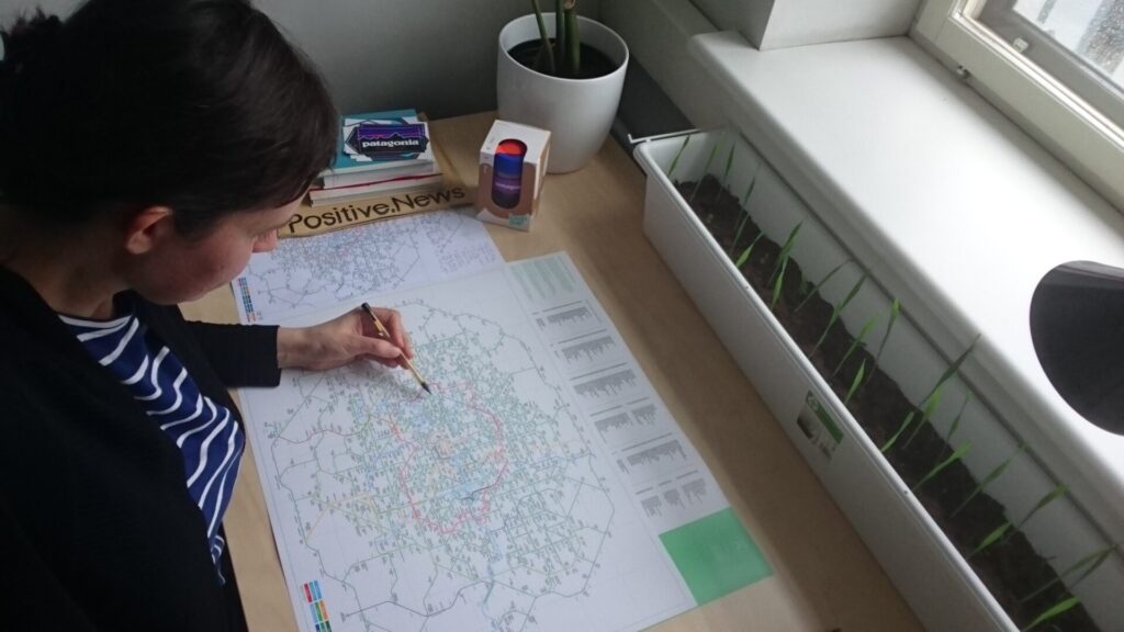
I think navigating information is going to be our next big challenge and I wanted to come up with something that people would find useful and I would enjoy making. The first London Greenground Map started from my own fondness of urban green spaces, walking and exploring. The Legible City walking maps (that actually started in Bristol) were still new and made things so much easier for walkers, but at the same time it was hard to get a whole picture. After the tube map moved to mobile it was even harder to get the scope of the city. My intention was to use natural features such as parks and rivers to make a large map people could use for navigating on foot or bike and understand where they are in London.
How do you want people to engage with your maps?
Many people are used to seeing cities through transport maps, but my maps inspire people to see cities through their green and blue infrastructure using the tube map format. Parks become ‘stations’ and green lines are suggested connections for walking or cycling between them. The intention of the map is not to replace more detailed geographical maps, but rather inspire people, who are used to schematic maps, return to seeing nature. Greenground Maps are navigation guides, but they do not (yet) work on their own – you would need Google or some other map engine for more detailed directions.
How did the maps evolve from London to Edinburgh and now Bristol?
London is one of my favourite cities, but it’s also huge and impossible to grasp so my fascination at first was to understand London better. I’ve always loved London green spaces and been captivated by the variety of parks and gardens so I guess I just wanted to get to know them. When I finished the first London map, which was just 10% of all the green spaces, I saw other people loved it too. As it was such an interesting project, I just kept going. I picked Edinburgh second as it’s a fascinating city with lots of urban green space. And Bristol came third as this is where I did my MA and have many fond memories of.
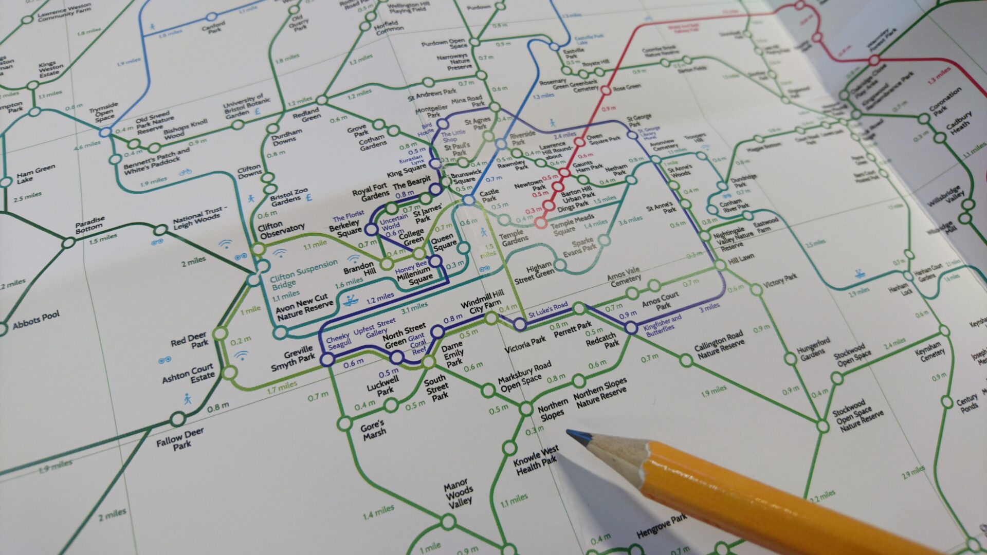
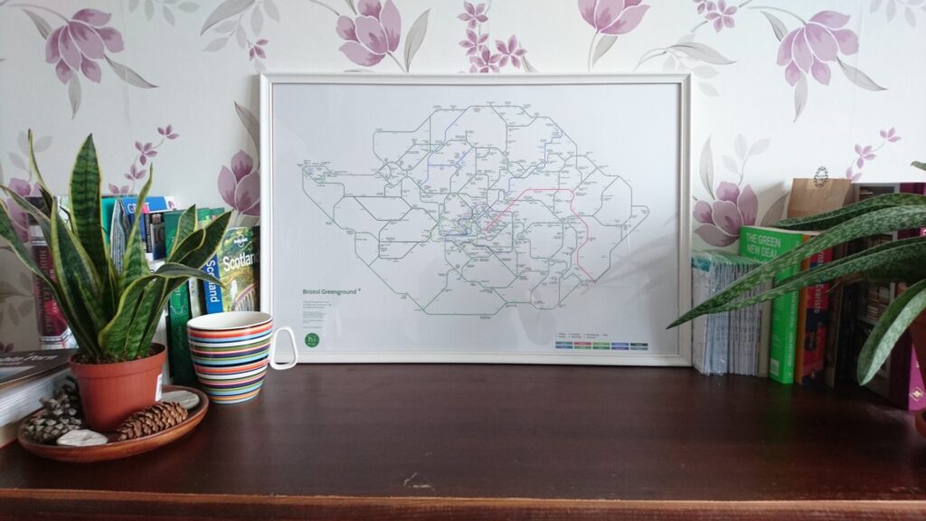
What does the Bristol Greenground map show?
The map connects the parks and open spaces to inspire walks (and bike rides) inside and further out in the city. With 10 inspiring green lines and around 250 green spaces to explore, the map includes inner Bristol, expands to other areas such as Portishead as well as links to surrounding countryside and the Bristol and Bath railway Path. Because Bristol is such a creative city and I have a creative background myself, I wanted to add the Street Art line with a few nature inspired murals on the way. I live that street artists are starting to get inspiration from nature and aim to bring nature back to the cities through their art.
What is your favourite green space/walks in Bristol?
My shared student house was in Bedminster, so I walked to Ashton Court frequently and spent lot of time exploring the grounds. Our campus was there as well, so it was lucky to be near this very leafy area of Bristol. I also liked walking to Clifton and the views over the town and Leith Woods near the Suspension Bridge. I remember looking towards the sea and wondering what’s beyond those trees, but I never ventured that far. So now I’ve made the Bristol Map I know that area a bit better. We often took a train to Bath on weekends, but we never walked or cycled there. So this is something I would still like to do as well.
Where can people buy your maps and posters from?
I sell the pocket maps and posters on my homepage at helenilus.com. I also sell London maps at Stanfords and Bristol maps may become available there too… keep an eye out!
What’s your next project?
This is still a secret, but I want to make a Copenhagen map next. I think people expect another UK city, but Copenhagen is such a cool city with great outdoorsy vibe. I’m looking forward discovering some European cities next.